Online Service
Contact Information
Changsha office 0731-88922097
Zhuzhou office 0731-22867780
DETAILSPAGEProduct CenterTechnical SolutionProject Case |
Particulars
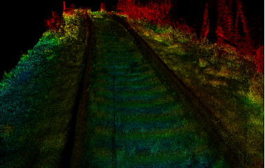
system introduction The system uses laser scanner, position, velocity sensor, inertial navigation and other data acquisition equipment, combined with ground modeling analysis software to analyze the distribution, uniformity and loss of the ballast. Provide reference for the flow direction and shaping scale of the distribution. The main function 1. Track track bed, real-time scanning of stone shovel distribution, modeling 2. The current speed measurement of the work vehicle is recorded. 3. Analyze the distribution of Dendrobium and output an analysis report.
|


